Archived Storm Damage Blog Posts
Winter Storms in Mississippi: How to Prepare Your Home and Prevent Damage | SERVPRO of Oxford/Batesville/Clarksdale
11/1/2024 (Permalink)
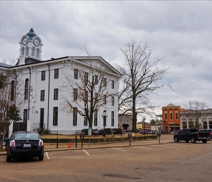 Prepare your Mississippi home for winter storms, and call SERVPRO of Oxford/Batesville/Clarksdale for help with repairs or damage.
Winter in Mississippi can bring an unexpected array of weather challenges. Although the state typically enjoys mild winters compared to its northern counterparts, it is not immune to severe winter storms.
Understanding the common types of winter storms and taking proactive steps to prepare your home can help you avoid significant damage and ensure your safety during the colder months. Here’s a look at the common winter storms in Mississippi and essential tips for winterizing your home to minimize risks.
Types of Winter Storms in Mississippi
Mississippi winters are often marked by various types of storms, including ice storms, freezing rain, and occasional snow events. Ice storms occur when rain falls and then freezes on contact with surfaces, creating a hazardous layer of ice that can accumulate on trees, power lines, and roadways.
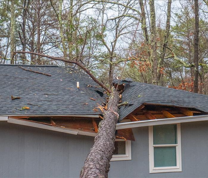
This can lead to power outages and significant damage from fallen branches. Freezing rain, while similar, tends to cause more gradual ice buildup, which can also result in dangerous driving conditions and potential home damage. Snowfall, though less frequent, can still impact the region, causing issues such as roof stress from snow accumulation and potential flooding if snow begins to melt rapidly.
Preparing Your Home for Winter Weather
To protect your home from the potential damage caused by winter storms, preparation is key. Start by inspecting your roof for any damage or wear. Make sure shingles are intact and that there are no areas where ice could accumulate and lead to leaks. Gutter maintenance is also critical; clean gutters and downspouts to ensure proper drainage and prevent ice dams, which can cause water to back up under shingles and into your home. Additionally, check your windows and doors for drafts and seal any gaps to keep cold air out and maintain heating efficiency.
Another important aspect of preparation involves ensuring that your home’s heating system is functioning properly. Schedule a professional inspection of your furnace or heating system to ensure it’s ready for the colder temperatures. This includes checking for any potential issues that could cause breakdowns during peak use. If you use space heaters, ensure they are placed away from flammable materials and are used according to the manufacturer's instructions to prevent fire hazards.
Safeguarding Against Ice and Snow
When it comes to dealing with ice and snow, there are several precautionary steps you can take to minimize damage. For ice storms, consider applying a de-icing agent to driveways and walkways to reduce the risk of slips and falls. Additionally, keeping an emergency kit with essentials such as non-perishable food, water, flashlights, and batteries can be invaluable during power outages caused by ice accumulation.
If snow is forecasted, be prepared to clear driveways and sidewalks promptly to prevent ice from forming beneath the snowpack. Investing in a quality snow shovel or snow blower can help manage accumulation and reduce stress on your home’s infrastructure.
By understanding the types of winter storms that can affect Mississippi and preparing your home accordingly, you can reduce the risk of damage and ensure your home remains safe throughout the season.
If you experience any winter-related damage or need assistance with repairs, SERVPRO of Oxford/Batesville/Clarksdale is Here to Help®.
Staying Safe When The Weather Is Severe | SERVPRO of Oxford/Batesville/Clarksdale
4/15/2024 (Permalink)
 SERVPRO of Oxford/Batesville/Clarksdale is Here to Help® restore your property to preloss condition after any storm.
While there are many benefits of living in the South, being in the path of tornadoes is not one of them. In the last few years, Mississippi has been leading the United States when it comes to the number of tornado touchdowns.
Since we experience severe weather relatively often in the early spring and summer, it is vital that you have a reliable plan in place to keep you safe while the weather rages outside. Use the tips below to help you better prepare for the next stormy season.
Planning Ahead
One of the most important things you can do during severe weather season is staying informed. This includes watching the news for the forecast, checking your weather apps periodically and making sure you have your weather alert systems up and running at any given time. If you know what is coming, you are much more likely to have the time you need to prepare and take shelter before it hits.
Another crucial task is to make sure you have your emergency kit ready to use. Include flashlights with extra batteries, your weather radio, chargers for your phones, a first-aid kit, any medications or glasses, and shelf-stable food and water. Severe weather can last a while and be really unpredictable, so having means to stay comfortable while you are hunkered down is essential.
A tornado watch means that the conditions are right for a tornado to form and drop down from the sky, but a tornado warning means that there has been one reported on the ground in the area. If a warning is issued, it is imperative that you seek shelter immediately.
After the Storm Passes
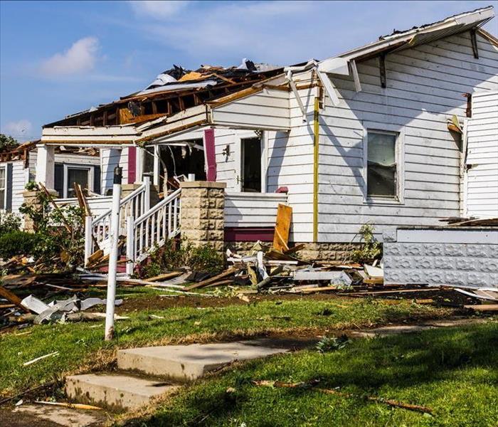
Tornadoes can have really specific damage patterns, so use extreme caution when leaving your safe shelter location. Entire homes can be flattened or sections of your house could have experienced structural damage that make your floors unsteady and walls unreliable. Walk carefully and slowly as you make your way outside to assess the damage.
Your first goal should be to connect with anyone who wasn’t home when the storm hit and to check on your neighbors. Just because a house looks undamaged on the outside doesn’t mean there is no damage or emergency happening inside. Once everyone has been deemed safe, it’s time to get on the phone with us.
One of the benefits about working with us is that we are locally owned and operated! We see the same forecasts you do and start preparing our homes and business just like you do, except we also start forming recovery teams and prepping trucks in preparation for your phone call after the storm passes on.
We will arrive quickly to assess the damage, and we will get to work right away to secure your home. We will board up windows, lay tarps over exposed sections of your home and start pulling undamaged possessions into another space for temporary safekeeping.
After that, we will remove standing water, lingering moisture and damaged debris. Once your home is cleaned and dry, we can get started on your structural repairs. It is our goal to make sure your home is returned to its pre-storm damage condition as quickly and as efficiently as possible.
Storms can cause serious damage to your property. Call SERVPRO of Oxford/Batesville/Clarksdale right away.
Responding to a Tornado Warning the Right Way | SERVPRO of Oxford/Batesville/Clarksdale
1/2/2024 (Permalink)
 Tornado damage is no match for the restoration and repair team at SERVPRO Oxford/Batesville/Clarksdale!
It always seems like we just finished up one tornado season, only to have to start preparing for another before we know it. While it is possible to experience a tornado at any point in the year in our community, it is much more common for them to touch down any time from March to November.
Preparing ahead of the stormy season is one of the best ways to prevent serious damage and to stay safe when the conditions are right for a twister.
Tornadoes, Explained
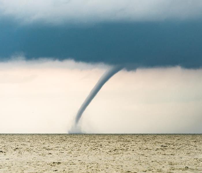
Tornadoes are one of the most destructive weather phenomena that we experience in the Oxford area. They are huge columns of rotating air that extend from the clouds to the ground and they can move at frightening speeds. A typical tornado can produce wind speeds of 250 miles per hour or more.
If you have ever been in the path of a tornado, you know that the atmosphere starts to change and the weather starts to become concerning. The sky can turn dark or even take on a greenish hue, low-lying clouds can start to rotate and a loud roaring noise similar to a freight train can indicate that a tornado is not far off. If you start to notice these changes or a tornado warning is issued, it’s time to seek shelter immediately.
Staying Safe During a Tornado
If you live in a mobile home, it is imperative that you leave your home quickly and head to the predetermined safe shelter area for your community. Mobile homes do not offer much, if any, protection when a tornado comes to town. If you live in a stable structure, head to your sheltering location immediately. Your ultimate goal is to get away from windows and to put as much space between you and the outside world as possible.
Once you are there, find a sturdy table or desk that you can crouch under. If your home is in the direct path of a tornado, there isn’t much you can do other than find ways to avoid getting hit with projectiles. Cover your head with your arms and stay covered until the tornado has passed on.
In some rarer situations, you may find yourself outside with no way of seeking safety when a tornado hits. If this happens to you, lie flat in a low-lying area and cover your head. Try to find a spot that is far away from trees, cars or other heavy objects as they can easily be picked up and thrown around.
Recovering Afterward
We have all seen coverage of tornado damage after a storm or have lived through it ourselves, so we know just how destructive tornadoes can be. If your home has been damaged in any way by the wind, rain and hail that severe weather can bring, call SERVPRO of Oxford/Batesville/Clarksdale immediately. Our team will respond right away to your call for help and we will get started on your recovery quickly.
Depending on how severe your damage is, you might be looking at temporary alternative housing, which is why we prioritize working quickly and efficiently throughout the entire process. It is our goal to minimize disruption as much as possible so you can make a full recovery faster.
Don’t wait to address tornado damage. Call SERVPRO of Oxford/Batesville/Clarksdale right away.
The Stages and Categories of Hurricanes
8/22/2022 (Permalink)
During Hurricane Season, you tend to hear TV meteorologists talking about different terms and categories to classify the storm. What do they actually mean?
Where do hurricanes actually begin? As a storm builds from a thunderstorm to a hurricane, it passes through 4 distinct stages:
Tropical Disturbance: a mass of thunderstorms that have wind speeds of less than 23 mph.
Tropical Depression: consistent wind speeds of 23-39 mph and circulation of wind in the center of the thunderstorm mass is detected.
Tropical Storm: forms when the maximum sustained winds have intensified to 39-73 mph. Storms are typically given a name at this stage and are characterized by problems caused from very heavy rainfall.
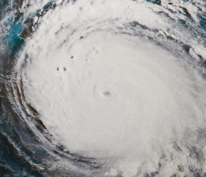
Hurricane: finally forms when surface pressures continue to drop, and winds reach 74 mph. There is now a clear and definite rotation around a calm center or eye.
Hurricanes have their own categories which are defined by the Saffir Simpson Hurricane Wind Scale:
Category 1: Winds 74 to 95 mph (Minor damage)
Category 2: Winds 96 to 110 mph (Extensive damage — Can uproot trees and break windows)
Category 3: Winds 111 to 129 mph (Devastating — Can break windows and doors)
Category 4: Winds 130 to 156 mph (Catastrophic damage — Can tear off roofs)
Category 5: Winds 157 mph or higher (Can level houses and destroy buildings)
This scale only estimates property damage that could occur with the maximum sustained wind speed of a particular hurricane; it does not consider the potential for other dangerous events that often accompany hurricanes, like tornadoes, flooding, and storm surge.
Calm Waters
8/17/2022 (Permalink)
Before the 2022 Hurricane Season started, the NOAA predicted an above-average season to rival the extremely active 2021 season. The Gulf Coast and other areas braced themselves for an influx of tropical weather, and then...
Nothing happened. There have only been 3 named storms since the beginning of the season in June.
Many areas in the Gulf were affected by drought conditions through the spring and summer months, and the Hurricane Outlook was officially downgraded at the beginning of August.
So, is everything all clear? Not exactly.
Now that it's mid-August, there are some disturbances and tropical waves showing up on the radar. These could eventually turn into named storms that affect the Gulf Coast and surrounding areas. We're heading into the peak of Hurricane Season, and anything could happen.
If it does?
We'll be there. SERVPRO of Oxford/Batesville/Clarksdale has assisted our national Storm Teams in areas affected by strong hurricanes. We're ready to do it again.
We're always here to help.
When You Lose Power in Oxford, MS
6/27/2022 (Permalink)
 Some power outages are lengthy
If you've been in Mississippi for a minute, you know that there's always a chance of sudden severe weather situations. We're only a few days into summer, but there's already a line of thunderstorms on deck for Oxford. During the day, should your power go out during a storm, it's just an inconvenience to most people.
When it's knocked out at night, it can be treacherous.
Could you find your way around your home in the middle of the night? If the answer is no, it's probably a good idea to keep a small flashlight in each bedroom so you can quickly access it when you need it!
Many power companies send text alerts to let you know when your power might be restored. Depending on the severity of the storm that caused it, it could be awhile. This is especially true for those in more rural locations.
That's when it gets a little tricky.
Ideally, if you've experienced a prolonged power outage in the past, you want to be prepared for next time. This might mean having a portable generator, or even a whole-home generator.
Generators can be a godsend when dealing with power that will be shut off for the immediate future. They'll keep your food cold and your TV on while you wait out the electric company. The trade-out is that portable generators, and especially whole-home generators require ongoing maintenance.
So what happens when you don't have a generator?
In short: the timer starts counting down on anything perishable in the house. The food in your freezer should hold for around 48 hours. Now the bad part: If there is a lot of food in your fridge, it should keep its temperature for around four hours. It's probably a good idea to have a large cooler and several ice packs available so the food can move to a cold cooler to make it last longer.
The next time storms blow through, we hope your power stays on. Familiarize yourself with these tips in case it doesn't. Stay safe out there and give us a call if you need us. From your friends at SERVPRO of Oxford/Batesville/Clarksdale.
The "I" of the Storm
5/13/2022 (Permalink)
 "I" storms usually arrive at the peak of hurricane season.
What's in a name? Specifically, the names used for hurricanes. The World Meteorological Organization releases a list of the hurricane names ahead of each year's hurricane season. In 1979, a permanent list of names was established by the WMO. The names rotate on a six-year cycle and are reused unless a name has been retired.
A name is retired when it is associated with a storm that was particularly costly or deadly, like Hurricane Katrina in 2005.
Which letter has the most retired names?
"I" can tell you that, as of the beginning of the 2022 Hurricane season, the letter I has 13 names that have been retired from use:
Ida (2021), Igor (2010), Ike (2008), Inez (1966), Ingrid (2013), Ione (1955), Iota (2020), Irene (2011), Iris (2001), Irma (2017), Isabel (2003), Isidore (2002), and Ivan (2004).
The 2022 I name is Ian.
Here's hoping he's gentle. Though, should it turn into a major storm, SERVPRO of Oxford/Batesville/Clarksdale is ready to hit the road and help make it "Like it never even happened."
We're always here to help.
Tornado Season 2022
5/2/2022 (Permalink)
 Stay safe this tornado season!
The 2022 Tornado Season has already been incredibly active in the south, and as we enter May, there doesn't appear to be many signs of slowing down. May has traditionally been the month with the most tornadoes, as the tornado season hits its peak.
That statement hits a bit different when you look at where our tornado season stands when compared to last year.
- March 2021 - 139 tornadoes recorded in the United States
- April 2021 - 79 tornadoes recorded in the United States
- May 2021 - 259 tornadoes recorded in the United States
Here's where we are as of May 1st:
- March 2022 - 226 tornadoes recorded in the United States
- April 2022 - 193 tornadoes recorded in the United States
- May 2022 - ???
You see the cause for concern.
People who have spent at least a few years in the South have an idea of what to do when a tornado watch or warning is issued for their area. But a refresher never hurt anyone, especially when the population has grown so much over the past few years!
- Many properties actually have storm shelters. These are ideal, but if that isn't an option, go to an interior room of the home. Bathrooms without windows tend to fare a bit better than rooms with outside walls.
- Keep cell phones charged to receive weather warnings and in the event of a power outage.
- Have a plan for yourself and your family in the event of a tornado. Don't forget your pets!
Tornadoes are a part of southern life during the spring. Should your home experience water damage from a tornado or wind event, SERVPRO of Oxford/Batesville/Clarksdale is always here to help. Give us a call at 662-281-1881.
When the Lights Go Out
11/10/2021 (Permalink)
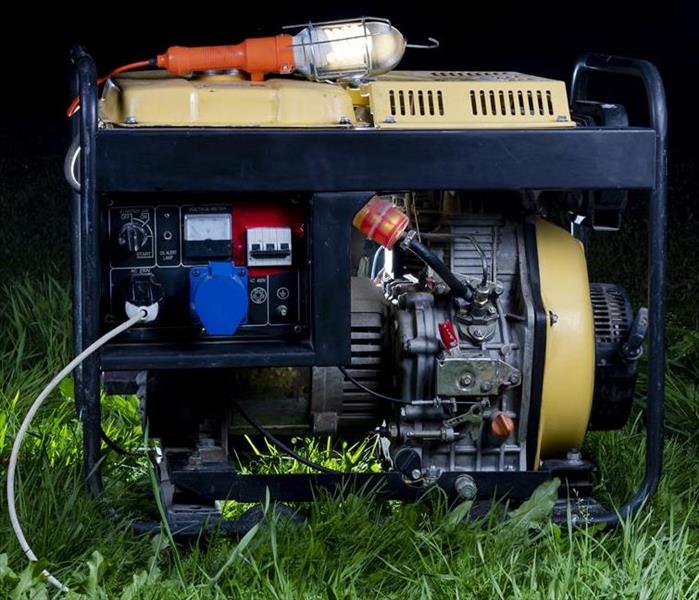
 A portable generator keeps the lights on when a storm leaves you in the dark.
A power outage is often an unfortunate after-effect of a storm. Whether it's due to a tornado, ice storm, thunderstorm, or hurricane, an electrical loss can range from merely inconvenient to life-threatening. When the lights go out, many businesses and homes rely on a generator to get them out of the dark. There are a range of generator sizes available, depending on your needs. A portable generator can handle important items like a refrigerator or freezer for a limited amount of time. These generators run on gasoline and must be frequently refueled. Another option is a whole-home generator. It is permanently installed outside of a home and uses liquid propane or natural gas for fuel. It is designed to kick on seconds after a power loss so the home will continue running as normal.
Which is right for your home? It depends on your needs. There are several online calculators to help you narrow down the size and style of generator that would be most beneficial for your needs.
There are some important safety measures to keep in mind when considering a generator for your home. Carbon monoxide poisoning is one of the primary dangers of improper generator usage. Carbon monoxide is produced as generators burn fuel. It is odorless and colorless, and in enclosed spaces, it can be deadly. Always make sure a generator is well-ventilated and kept at least 20ft from the home. It must be outdoors, so do not put it in your garage! Some more-modern portable generators have built-in sensors to shut off the generator in the event of too much carbon monoxide. This is incredibly beneficial, but it's important to set up your generator in the proper location before first use!
A portable or whole-home generator is a great standby source of electricity during a power outage. They also save you money during a prolonged outage by keeping your refrigerator and freezer operational, preventing major food loss! Be sure to buy the correct size generator for your home to prevent overloading it. Keep a gasoline-powered portable generator away from your house to prevent carbon monoxide buildup. Use it properly and keep it maintained so the next time your neighborhood has an outage, you can be the light in the dark!
Fall Tornado Season
8/25/2021 (Permalink)
 Cool season tornadoes are a possibility in Mississippi! Have a safety plan in place.
Tornado season usually happens in the spring. Warm fronts and cold fronts collide as winter fades to an end, and when this happens, it can result in unstable weather patterns that can form tornadoes. People typically think of the midwestern plains states like Oklahoma and Kansas in regards to high tornadic activity, but as just about anyone who lives in the South can tell you -- tornadoes come through here, too! While parts of the South experience tornadic weather in the spring, there is an increased risk of tornadoes forming later in the year. This is mostly due to the warm Gulf waters that keep the Gulf Coast warm while the weather begins to turn cool for the rest of the country. Just like in the spring, this often makes atmospheric conditions favorable for strong thunderstorms that can spawn tornadoes.
What atmospheric conditions need to be present for tornado formation? There are four: Shear, Lift, Instability, and Moisture, or SLIM, for short.
SHEAR means the wind shear. This refers to the speed and direction of the wind, which can increase rotation during a thunderstorm.
LIFT could be a warm or cool front that encounters the thunderstorm and pushes it up, sometimes resulting in rotation.
INSTABILITY is exactly that -- the atmosphere is a mix of different elements, like when a cool front encounters warm ground temperatures. When wind shear is introduced, it lifts through the storm clouds and intensifies the thunderstorm.
MOISTURE means humidity. Southern states are traditionally very humid, and warm weather lasts longer throughout the year. The extreme humidity is like gasoline to thunderstorms.
When these atmospheric conditions combine, it increases the likelihood of a tornado breakout. Pay attention to weather forecasts, and have a safety plan for yourself and your family.
The Dangers of Flash Floods in Oxford, MS
8/18/2021 (Permalink)
 Flash floods can escalate quickly. Have a plan of what to do and where to go!
Flash flooding becomes a very real danger once an area experiences an overabundance of rain in a very short period of time. The ground becomes overly saturated from the heavy rain, so it cannot absorb any more. This causes water to rise and expand, which is how roadways become flooded and structures take on water. Flash floods move very quickly and are very strong. It only takes six inches of water to knock you down and sweep you away. A foot of floodwater can do the same to a vehicle, so you should never walk or drive onto a flooded roadway.
The National Weather Service reports that flash floods are the number one cause of weather-related deaths in the United States. These fatalities are overwhelmingly automobile-related. You should never drive onto a water-covered roadway because you don't know the depth and speed of the water. A car can be swept away before the driver even realizes the extent of the danger.
Flash floods are more destructive in densely populated areas because more land is covered by roads and buildings. Once the remaining ground is saturated, there is nowhere for the excess water to go, so it begins to rise. Storm drains are often clogged with debris, which adds to the problem. Low areas become extremely dangerous in situations like this.
Seek higher ground should your area fall under a Flash Flood Warning. If asked to evacuate, do so immediately, because there is often not much time to react. Seconds count. Have a disaster plan in place for your family so you know what to do and where to go. Practice it if your area is expecting heavy rains. Above all, stay calm and stay safe.
Should your home or business be damaged due to a flash flood, SERVPRO of Oxford/Batesville/Clarksdale is here to help. Call us at 662-281-1881. We're available 24/7 and will work with you to make it "Like it never even happened."
How Hurricanes Get Their Names
7/1/2021 (Permalink)
 The storm name "Sally" was retired after Hurricane Sally devastated the Gulf Coast in September 2020.
Have you ever wondered why hurricanes and tropical storms are given proper names? Typically, it's to avoid confusion. Hurricane season hits its peak phase from mid-August through mid-October of each year, so during that time, there could be several tropical storms or hurricanes forming in the Atlantic at the same time. A short name gives meteorologists and scientists and easy way to classify them. The United States adopted the practice of naming hurricanes in 1953, but until 1978, the hurricane name list only included female names. The 1979 Atlantic Storm Name list began including male names. The names are maintained by the World Meteorological Organization.
Ever thought you've heard a storm name from the past? You probably have! The official storm name list rotates and recycles every six years. Certain storm names are permanently retired for sensitivity purposes, due to the costliness or deadliness of the original storm. There could only be one Hurricane Betsy, Hurricane Camille, Hurricane Katrina, etc. Once was enough!
Should an extremely active hurricane season produce more than 21 named storms (such as 2020), a different set of names is used. Prior to 2021, the Greek alphabet was used as a backup list, since it was rare for such a large number of storms to form during the season. The 2020 hurricane season was so active and devastating, more than one Greek-named storm met the criteria for name retirement. Beginning in 2021, an entirely new alternate list of names has been approved to back up the main list of storm names.
While it's fun to see if your name or the names of your friends and family made the list, hurricanes can wreak havoc once they make landfall. SERVPRO of Oxford/Batesville/Clarksdale keeps an eye on the weather, and can assemble a traveling storm team at a moment's notice to help those affected by the devastation.
We're always here to help.
The 2021 Atlantic Hurricane Season
5/14/2021 (Permalink)
 Our storm team hit the road, ready to help once Hurricane Sally left a path of destruction in Gulf Shores, AL.
The 2020 Atlantic hurricane season shattered records. The National Hurricane Center had to move on to the Greek Alphabet for storm names after the season produced thirty named storms. Once a tropical storm has maximum sustained wind speeds of 74mph, it is then classified as a hurricane. This happened thirteen different times in the 2020 hurricane season. Should the wind speed increase above 111mph, it is then considered to be a major hurricane. Six of the thirteen 2020 hurricanes met the criteria for a major hurricane.
The official 2021 Atlantic hurricane season begins June 1st and runs through November 30th. The past six hurricane seasons got a jumpstart on the date, so as of this year, the National Hurricane Center will begin issuing tropical weather outlooks for the Atlantic on May 15th, 2021.
Last year's hurricane season was so turbulent, that means the 2021 season shouldn't be so bad, right?
Not so fast.
Experts predict an above-average probability for a number of major hurricanes to make landfall in 2021.
While tropical weather doesn't usually reach Northern Mississippi, SERVPRO of Oxford/Batesville/Clarksdale keeps an eye on potential hurricanes and stand ready to assemble a storm team to go to the affected area and assist if it becomes necessary.
We're always here to help.
The Dangers of Nocturnal Tornadoes
5/4/2021 (Permalink)
 Nighttime tornadoes can be both devastating and deadly.
The recent tornado emergency in Tupelo, MS highlights an uneasy fact about many Southern tornadoes: They strike in the dark hours of the night. Tornadoes are massively unpredictable. A small funnel cloud descending from a strong thunderstorm can explode into a monster once it touches the ground. It's bad enough when they happen during the daytime, but the danger intensifies exponentially once a tornado touches ground at night.
Tornadoes that strike between 9 pm and 6 am are known as Nocturnal Tornadoes. These tornadoes are more than twice as likely to be deadly for a number of reasons. Primarily, it's next to impossible to see a tornado at night. Meteorologists rely on storm spotters to let them know if they confirm a tornado on the ground; fewer spotters are on the road late at night, so that makes it more difficult to broadcast precise, accurate information about the location of a tornado. Not only that, more people are usually asleep late at night, so they might miss the warnings altogether. While tornado sirens typically go off during a storm, someone who lives further away from the siren might not be able to hear it over the sound of the rain. A sound sleeper may not wake at all, which could be devastating if they live in a mobile home or other structure unlikely to withstand high tornadic winds.
Nocturnal tornadoes have a higher likelihood of striking in southern states. The states with the highest percentage of tornadoes that strike at night are Tennessee (46%), Arkansas (43%), Kentucky (42%), and Mississippi (39%). Southern states are vulnerable to nighttime tornadoes for many reasons. Winters are generally mild in the South, which means that a tornado can strike at any time of year. Once the time changes in late fall, it gets dark much earlier, making any potential tornadic weather more dangerous. Additionally, Southern states have a much higher instance of residents living in mobile homes. These factors overlap as a very real threat of danger whenever tornadoes are a possibility.
There are some tools available to assist those in vulnerable areas. The National Weather Service sends wireless emergency alerts, as well as many weather apps available on Android and iPhone. NOAA weather radios are also available; they broadcast a loud tone, followed by the weather warning. This could be enough to startle awake a heavy sleeper with enough time for them to get to safety.
Tornadoes are unpredictable and potentially devastating. Should your home or business suffer a loss from a tornado, SERVPRO of Oxford/Batesville/Clarksdale is always here to help. Give us a call at 662-281-1881 to discuss your needs. We're available 24/7/365. We'll make it "Like it never even happened."
Hurricane Sally 2020
11/13/2020 (Permalink)
Hurricane Sally made landfall on September 16, 2020 causing catastrophic damage to the Alabama and Florida coast. Sally began her journey of destruction on the coast of South Florida on September 11 beginning as a Tropical Depression. The next day she strengthened into Tropical Storm Sally over the Gulf of Mexico. The Florida Keys were met with flooding rainfall on September 12. She then moved northward over the eastern Gulf of Mexico and by September 14 Sally had intensified into a hurricane. Slowly this hurricane made its ways towards to coastline and on September 16th it strengthened to a category 2 hurricane and made landfall causing flash flooding.
And like SERVPRO always does, we banded together to go help with relief efforts and helping those in need begin their journey of recovery. SERVPRO of Oxford/Batesville/Clarksdale loaded up on September 17 and got to work. Our crews were on site for a whole month and were able to help over 20 families and a large apartment complex. We are grateful to have the opportunity to travel to these heavily affected areas and help so many people make it “Like it never even happened.”
Is Storm Water Clean Water?
8/26/2020 (Permalink)
People often perceive storm water to be clean and free of pollutants. Take for example all the children and pets that love to play in puddles after a rainstorm. However, that is not always the case. Especially when water is left stagnant or seeps into your home. The Institute of Inspection Cleaning and Restoration Certification (IICRC), who sets the standards for the cleaning industry and water damage restoration training, says that there are three levels or types of water damages.
Category 1: Clean Water
This type of water comes from sanitary sources or sources that you would normally get water from. This may include faucets, burst water pipes, or vertical falling rainwater.
Category 2: Grey Water
This type of water is worrisome if left for a long period or if ingested. Grey water comes from incidents such as washing machine, toilet, or dishwasher overflows.
Category 3: Black Water
This is easily the worst classification of water. Black water can cause illness if ingested and has the potential to destroy a home and its contents. Sewer backups, flooded rivers, feces tainted toilet overflow, and stagnant bacteria riddled water all fall into this category.
If you experience water damage in your home after a storm or accident, it is important to act fast. SERVPRO specialists can quickly assess the scene and determine what remediation steps need to be taken. With our professional help, your flooded home can be restored to its original condition. Call us at 662-281-1881!
Seeking Shelter During a Storm
8/24/2020 (Permalink)
Thunderstorms are quite common during the warm summer months. However, that does not make them any less frightening and dangerous. Big storms can be very overwhelming, especially for pets and children. They can be even more stressful when you are away from your home. Knowing your shelter options can help relieve some of the added tension of a storm.
Thunderstorms often appear out of the blue. It is important to be aware of proper safety protocols to follow when you are caught in a storm. Here are some alternative solutions for sheltering during a thunderstorm when you are away from home:
- In a Store or Mall: any commercial structure is a great option for shelter. These buildings are sturdy and a good place to wait out a thunderstorm.
- In the Car: contrary to popular belief, sheltering from a storm in your car is quite safe, provided you can take proper precautions. Pull over somewhere that is safe, turn off your engine, switch on your hazards and avoid touching anything metal in the vehicle for the duration of the storm. Even your steering wheel, gear shift and radio knobs may contain metal, so keep your hands off just in case.
- On Low Ground: If you are caught outside away from your car or buildings, make sure to avoid hill tops and other high land. Instead, crouch in an unexposed area away from tall structures. This includes trees, flagpoles, fences, etc.
If you experience storm damage to your Oxford, MS home or office building, our experienced technicians are ready to help. Contact us at 662-281-1881 any time!
Summer Thunderstorms
7/31/2020 (Permalink)
The two most basic elements that create a thunderstorm are:
1. Moisture2. Rapidly rising warm airTherefore, it makes sense that thunderstorms occur more often during the summer months. This is especially true for Southeastern US. Thunderstorms bring strong winds, thunder, lightning, and heavy rain. This is a recipe for disaster when it comes to leaks and other problems. It is important to take precautionary measures to protect your home from storm damage. Here are five preventive steps you can take before a storm:
- Clear away outdoor items: make sure all lawn furniture, gardening tools, equipment, and other items are stored away so high winds cannot blow them away or into your home. - Trim the trees: it is important to trim down oversized branches that could fall into your home or vehicle. - Install storm shutters: windows are especially vulnerable to damage during a storm. Impact resistant shutters or impact resistant glass can prevent your windows from shattering. - Have standby power: a whole-house surge protective device runs around $200-$300 and is not difficult to install. For severe weather, it is worth considering a home generator to prevent long-term electricity outages.- Check your house for weaknesses: high winds can cause week spots in your home to fail. Be sure to check the roof, windows, doors, and garage door. Stay safe during this storm season by following these tips. If you do find that your home has suffered from storm damage, our team here at SERVPRO is ready to help. Call us at 662-281-1881!
Act Fast After A Flash Flood
7/20/2020 (Permalink)
Flooding is a year-round threat to every state in the US. The most common cause of flooding is water due to rain and/or snow melt that accumulates faster than soils can absorb it, or rivers can carry it away. Flooding, specifically flash floods, are common to Mississippi. Flash floods generally develop within 6 hours from excessive rainfall and are the most frequently occurring natural disaster.
Flash Flood Warning vs Flash Flood Watch
- Watch: conditions are ripe for a flood, but one has not been spotted
- Warning: a flood is occurring or is imminent within the next hour
Some terrains that are more prone to flash flooding include:
- Low lying areas
- Areas near water
- Areas near steep hills or gullies
How to Secure your Home:
- Turn off utilities at main switches/valves and disconnect appliances.
- Do not touch electrical lines or equipment if you are wet or standing in water.
- Move essential items to an upper floor our elevated space.
- Bring in outdoor furniture/belongings.
If your home has experienced water damage from flash flooding, SERVPRO of Oxford/Batesville/Clarksdale is here to help! Call us at 662-281-1881!
Lightning Safety
6/18/2020 (Permalink)
Lightning strikes are a serious safety hazard and can be the cause of extensive property damage. This is because lighting may cause fires, power surges, and shock waves. In 2015, over 99,423 lightning claims resulted in over $700 million in property damages. This may seem scary, but there are some easy ways to protect yourself and your home during the spring and summer seasons.
There are some important safety precautions to take when inside your home during a lightning storm. Firstly, avoid all water sources. This includes bathing, showering, washing dishes, etc. Lighting can travel through your home’s plumbing systems. Secondly, avoid using electronic equipment such as computers, game systems, washers, stoves, or anything else connected to an electrical outlet. Lastly, avoid windows, doors, porches, and concrete. Lightning can travel through concrete due to the metal wires running through it.
There are also some ways to directly protect your home from damages. First, make sure to equip your home with whole-house surge protectors to protect appliances. Second, install lighting rods to protect from a direct lightning strike. Homes struck by a direct strike are more likely to catch on fire. Lightning rods work by creating a conductive path for the harmful electrical discharge to follow and disperse the energy safely into the ground.
Fall Weather Threats
11/13/2019 (Permalink)

Autumn is finally upon us, meaning pumpkin spice, football, and sweater weather. While most fall days are some of the most pleasant weather days of the year, there are also significant opportunities for weather threats. Some of these threats can be caused by cold, dry air and warm, humid air clashing causing air masses that can then turn into severe thunderstorms during the months of October and November. A second threat that can come from fall weather is intense fog. Fog can be severely dangerous for motorists and cause several traffic accidents. The cause of fog increasing during the fall season is due to cooler, longer nights. Fog usually develops during overnight hours and carries into early to mid-morning hours. The third threat caused by fall weather is frost. Frost occurs mostly in rural areas because there are more wide-open spaces. A fourth occurrence of fall weather is snowstorms. Now, we live in the south, so this is unlikely to happen here, but stranger things have happened. As we all say, “That’s Mississippi weather for you!” While most snow is light and powdery and perfect for skiing or snowboarding, fall weather can be mostly wet and heavy. This is especially dangerous because snow accumulates of leaves that haven’t yet fallen. This accumulation causes more weight and the trees are more likely to have broken branches or snap. These branches or fallen trees could damage a home, car or cause power outages if they land on a power line. Heavy and wet snow can also cause the roadways to become more slippery and slushy causing crashes. The final threat caused by fall weather is hurricanes. The peak of hurricane season is September, but the season doesn’t end until November 30. Sea surfaces remain warm even during cooler times which can cause cyclones to occur. Hurricane Matthew is the most recent late season hurricane to hit the US.
Be Prepared for a Hurricane
8/26/2019 (Permalink)
It is important to be prepared for fall storms. Extreme fall weather, such as hurricanes can cause unexpected damage, so knowing what to expect can help you be prepared.
Torrential downpours, extreme winds, floods and power outages are just a few of the effects of a hurricane. According to NASA, hurricanes are the most violent storms on Earth. A hurricane is fueled by just two things; heat and water. This is a dangerous combination and causes horrendous damage.
A few tips to help you “stormproof” your home are:
- Trimming trees or removing damaged trees and limbs
- Make sure your rain gutters are free of debris and fixed in place
- Reinforcing the roof, doors and windows
- Have a power generator and fuel ready
- Build a “safe room” to take shelter during a hurricane
It is also important to have supplies ready and on hand
- A three-day supply of non-perishable food
- Gallon of water per person for three days
- Flashlight with extra batteries
- First aid kit
If you or your family suffer damages from a hurricane, call SERVPRO. We are always “here to help.”
Use Hurricane Shutters to Protect Your Home
8/26/2019 (Permalink)
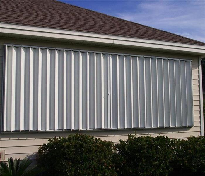
Mississippi is prone to hurricanes and tropical storms. It is important to be prepared for the heavy rain and strong winds that accompany these natural disasters. One way to do this is by installing hurricane shutters on the outside of your home. There are several different types of storm shutters; keep reading to learn which type may be right for you!
Accordion
These are permanent shutters made of polycarbonate or metal. They are very strong and effective. An accordion shutter is attached to the side of a window and can be unfolded and locked into place. These run about $15-$25 per square foot.
Bahama/Bermuda
Bahama awnings are ideal for those living in hot, sunny climates. Besides protecting from falling debris, they also provide necessary shade. These cost between $15-$20 per square foot.
Roll-Down/Roll-Up
This type of storm shutter is perfect for those who want a permanent change to the outside of their house. They are made from polycarbonate or quality metal. They protect from high winds while also providing privacy and insulation. These are pricier, averaging $20-$30 per square foot.
Colonial
The colonial security shutter looks very similar to a traditional decorative shutter. However, it can be bolted into place during a storm. The price varies from $200-$500 per individual window.
Storm Panels
Storm panels are used for temporary protection from a storm threat. They often come in steel, aluminum, or polycarbonate. These average around $100 per window.
Recap of Hurricane Barry
8/3/2019 (Permalink)
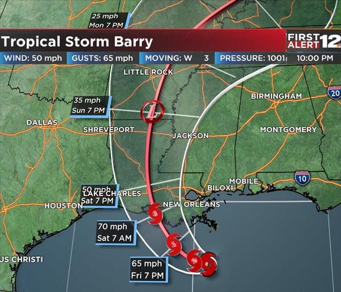
 Hurricane Barry's path across Louisiana
Barry originated from a cluster of thunderstorms in the Plains around the fourth of July. This cluster of storms started a spinning formation which eventually moved into the Gulf of Mexico. Barry made landfall along the Louisiana coast as a Category 1 hurricane on July 13, 2019. This caused extremely heavy rainfall and flooding in Louisiana and Arkansas. In fact, Arkansas may have set a new state record for the most rainfall from a tropical cyclone. The peak storm surge inundation occurred where Barry made landfall creating a surge of 6 to 7 feet above normal high tide level. The strongest winds were generally east and south of the center of the hurricane near the Gulf coast. Luckily Barry was only briefly categorized as a hurricane and did not cause any catastrophic damages.
Mississippi River Flooding
7/24/2019 (Permalink)
At over 180 days and counting, the Mississippi river has been above flood stage for the longest period in recorded history, surpassing the 1927 flood record of 152 days.
The U.S. Army Corps of Engineers has been working tirelessly to manage the river’s flood waters and prevent additional flooding to communities across the Mississippi River Valley. Communities upriver have experienced devastating flooding, but luckily those in and around Louisiana have been largely protected from flooding as a result of the Mississippi River & Tributaries System.
Nearly 170 trillion gallons of water have flowed down the Mississippi River since the start of the year. This volume of water is 60% greater than the 10-year average!
This is certainly the longest flood of our time. 2019 will be remembered as record breaking and the most unprecedented flood in recorded history.
Protecting your home from storm damage
6/21/2019 (Permalink)
During the summer, warm weather and sunshine are often accompanied by strong winds and heavy rain. It is important to know what you can do to prevent storms from wreaking havoc on your home this season.
- Inspect your foundation: cracks in your home’s foundation may lead to unwanted water seeping in during a storm.
- Check for dead trees: dead and diseased trees may not be able to hold up against strong wind and rain during a storm. A fallen branch or limb has the potential to cause major water damage.
- Clean your gutters: clogged gutters cause water buildup around your roof. Over time this may lead to a major water loss.
- Have your roof inspected: finding any flaws or issues ahead of time will allow you to fortify your roof in preparation for a storm.
Polar Vortex in Flint, MI
6/20/2019 (Permalink)
 We are always here to help, no matter where the disaster strikes!
Mother nature She can cause hurricanes, tornadoes, extreme heat, and extremely cold weather. SERVPRO of Oxford/Batesville/Clarksdale travels all over the United States when disasters strike.
The most recent storm we helped on was in Flint, MI. This past winter, a severe cold wave caused by a weakened jet stream around the Arctic polar vortex hit the Midwestern United States. It brought the coldest temperatures in over 20 years to most locations in the affected region, bringing up to 13 inches of snow in some regions from January 27-29. So, as a result of this weather, many homeowners and businesses pipes burst. So, our team loaded up drying equipment and tools and headed to Michigan. They endured the cold temperatures and helped around 20 homeowners get back to normal.
SERVPRO of Oxford / Batesville / Clarksdale is always ready for any size disaster, no matter where it happens.
Hurricane Florence Headed To The East Coast
9/10/2018 (Permalink)
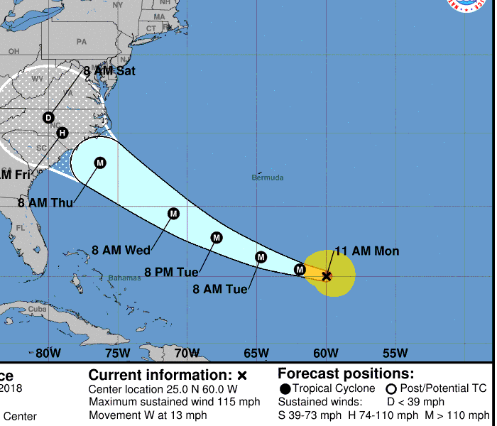
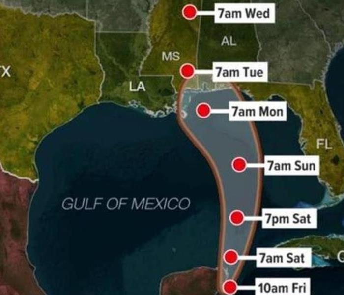
 Predicted path of Hurricane Florence from the Hurricane Storm Center.
Hurricane Florence has developed into a Category 4 major hurricane over the weekend. It is currently southeast of Bermuda and is tracking to hit the east coast of the United States later this week. As of now it is predicted to come with a storm surge, destructive winds and lots of rainfall. Hurricane Florence has the potential to be on the strongest storms recorded on the East Coast.
If you and/or friends or family are on the East Coast in the area predicted to be in Hurricane Florence’s path now is the time to develop or review your preparedness plan. Be sure to follow orders from local officials for your safety.
If you don’t have a plan of what do just yet, The Weather Channel has some helpful links on what you can do to be prepared if you are in the path as well as what to do after the storm. Just visit http://www.flash.org/hurricanestrong/ and follow the links as well as watch these helpful videos.
What's The Difference Between A Watch And A Warning
8/24/2018 (Permalink)
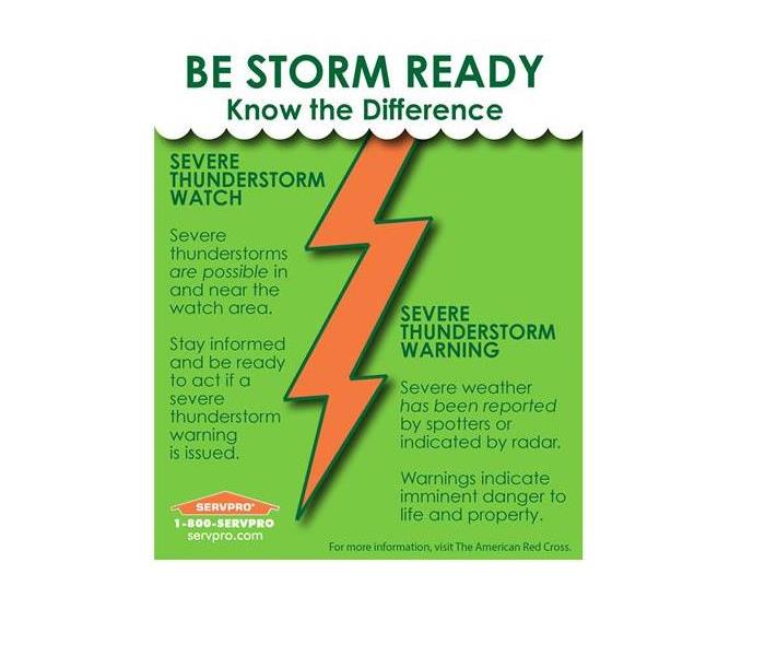
Summer’s in the south bring many rain storms. It's important to stay aware of severe weather watches and warnings and to know how to react. A watch means that conditions are favorable for severe storms. Watches are typically issued for large areas and are in effect for several hours. During a severe weather watch you don’t need to alter your plans just make sure you stay aware of the conditions.
A warning means severe weather is occurring or will be soon, and action should be immediate. Severe thunderstorms are capable of producing damaging wind and possibly hail.
One thing to remember is that lighting happens in every thunderstorm. This does should not downplay the damage of a strike. During these conditions find a safe place such as the inside of a sturdy building and keep informed of the conditions and remain there until it’s clear.
2018 California Wildfires
8/8/2018 (Permalink)
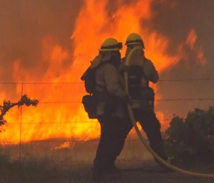
 Firefighters working on active wildfire.
Northern California was declared a national disaster on Aug 4, 2018. There’s been over 5,000 fires that have burned an area of 712,135 acres as of 7th of August. These fires are still ongoing but have already been named the largest in California’s history.
There are many factors that led to the 2018 wildfire season in California being so devastating. One of these direct causes was the increase in dead tree fuel in the state, there was a record 129 million dead trees. The atmospheric conditions aren’t helping the matters either, increasing temperatures and dryness have increased the wildfire risk. Also, home development in these areas has increased over the years it has increased the number destroyed when these events occur.
Along with decreased air quality there have been fatalities associated with these fires. The death toll is up to 12 and there are still people unaccounted for in these communities included firefighters working to put them out.
Summer Rain Storms Can Cause Roof Damage
7/25/2018 (Permalink)
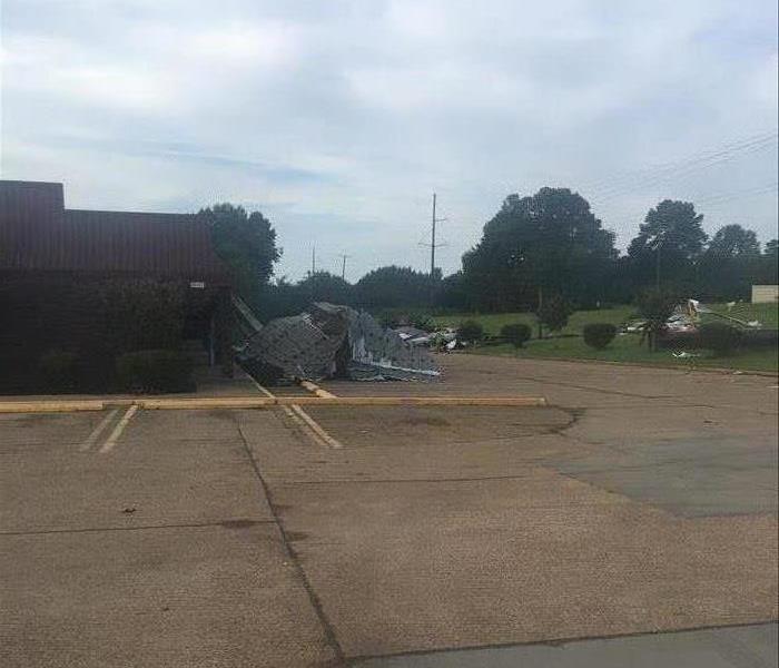 Roof damage to a Batesville, MS hotel after a summer storm.
The summer months are mostly categorized by the heat and humidity. Most people stay inside and limit their outside activities during the hotter times of the day. One thing people don’t normally complain about in the summer is the rain, it lowers the temperature and makes the outside more bearable most of the time. However, in some cases, these higher temperatures bring summer storms. The rain storms this summer have not only caused some flooding but roof damage as well. Here are some tips on how to check your roof for damage following a storm:
- Look for damaged or broken shingles
- Check for tears or buckling in the flashing
- Make sure gutters are free of debris
- Chimneys shouldn’t be leaning or missing/loose flashing
- Inspect the inside of your home for moisture marks
If you see any of these signs you should get them fixed immediately. The longer you wait more damage can occur. You should also consult your insurance and see if you should file a claim. If you suspect moisture inside your home, SERVPRO of Oxford/Batesville/Clarksdale has the equipment and training to effectively dry your home to keep secondary issues such as mold from happening.
Top Tips For Tornadoes
7/12/2018 (Permalink)
Tornadoes are something we’ve become more accustomed to in North Mississippi. They can be violent storms that can demolish even the best made structures. Tornadoes can uproot trees and throw other objects around. Here are three top tips to keep in mind about tornadoes from the American Red Cross:
- Identify a safe space in your home where your family and pets can gather. It should be the lowest floor, most interior room, with no windows.
- If you find yourself in a high rise building just find a hallway that is in the center in case, you do not have time to get to the lowest floor.
- If in a mobile home, find a safe place close by, no mobile home is safe in a tornado.
One last think to keep in mind is to know the difference between a Tornado Warning and Tornado Watch. A Tornado Watch means the conditions are probable for activity whereas a Tornado Warning means one is near or could occur soon so find a safe space immediately.
2018 Hurricane Season
7/2/2018 (Permalink)
 Subtropical storm Alberto hit land on May 28, 2018.
Hurricane season is described as a continuous event in the formation of tropical cyclones in the Northern Hemisphere. The season officially began on June 1, 2018 and will end on November 30, 2018. This is the period of time they are most likely however, it is possible at any time of the year.
This seasons forecast is to be a average for 2018 with a total of 11 named storms, 4 hurricanes and only 1 major hurricane. These numbers are because of the continued cooling in the Atlantic and an increasing chance of El Nino forming later in the year.
Here’s some tips from FEMA on how to prepare for future hurricanes:
- Know what you should do before, during and after a hurricane
- Create an emergency communication plan with your family
- Know your local community’s evacuation plans
- Check your insurance coverage
- Have emergency supplies at home
- Download the FEMA mobile app
Tornado Damage in Alabama
5/14/2018 (Permalink)
 SERVPRO of Oxford / Batesville / Clarksdale is ready to help you start rebuilding after the storm.
SERVPRO of Oxford / Batesville / Clarksdale main priority will always be the customers in our service area. We aim to be the premier cleaning and restoration company and the one you call when disaster strikes. Sometimes while taking care of our customers at home we also get to help some of our fellow SERVPRO’s throughout the country. This past spring, we did just that in Alabama.
In March, numerous tornadoes were sighted and one touched down in Jacksonville, AL. The damage from this F-3 tornado and the storms surrounding it left many homes and buildings with damage. One of the major benefits of choosing SERVPRO when this type of large disaster happens is our ability to gather resources. Just days later our crew from Mississippi was on the ground helping the crews in Alabama reach their customers and help them begin to rebuild.
When disaster happens call SERVPRO of Oxford / Batesville / Clarksdale, our 24/7 emergency service is ready to help!
Flood Waters Are Beginning To Go Down... Now What?
9/7/2017 (Permalink)
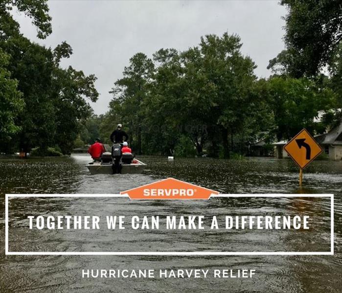
 Hurricane Harvey Relief Efforts
With all the hurricanes and natural disasters in the news right now, it is important to know the steps to follow once the rain and flood waters have left your home or business. The aftermath of the water damage can be overwhelming task to face and can sometimes feel impossible. This is where SERVPRO of Oxford/Batesville/Clarksdale motto of “Ready For Whatever Happens” comes in to play. Not only are our phone lines open 24/7 but we also have a staff of well trained technicians ready to help.
Here’s what you can do until help arrives per the American Red Cross:
- Continue listening to a NOAA Weather Radio or the local news for the latest updates.
- Stay alert for extended rainfall and subsequent flooding even after the hurricane or tropical storm has ended.
- If you evacuated, return home only when officials say it is safe.
- Drive only if necessary and avoid flooded roads and washed out bridges.
- Keep away from loose or dangling power lines and report them immediately to the power company.
- Stay out of any building that has water around it.
- Inspect your home for damage. Take pictures of damage, both of the building and its contents, for insurance purposes.
- Use flashlights in the dark. Do NOT use candles.
- Avoid drinking or preparing food with tap water until you are sure it’s not contaminated.
- Check refrigerated food for spoilage. If in doubt, throw it out.
- Wear protective clothing and be cautious when cleaning up to avoid injury.
- Watch animals closely and keep them under your direct control.
- Use the telephone only for emergency calls.
SERVPRO of Oxford, Batesville, Clarksdale Heads To Storm In Kansas
7/28/2017 (Permalink)
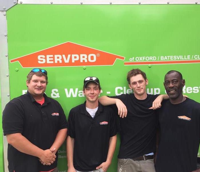 SERVPRO of Oxford, Batesville, Clarksdale on STORM in Kansas.
Throughout the year, all over the country, catastrophic natural disasters wreak havoc on communities large and small. Many times heavy rain fall over a significant amount of time can lead to flooding. This can cause homeowners to feel overwhelmed and confused on what should happen next.
SERVPRO of Oxford, Batesville, Clarksdale is always ready to help our local customers as well as other franchises that may experience natural disasters. Nationwide, SERVPRO has over 1,600 franchises who can mobilize and travel to assist in disaster clean up in communities across the United States.
The last week of July 2017 the Kansas City area received large amounts of rainfall that led to flooding in the area. Our SERVPRO of Oxford, Batesville, Clarksdale was asked to respond and travel to assist. Within 24 hours of receiving that phone call we already had crews in homes helping extract water and begin the drying process.
This should ease any hesitation you may have if you experienced the same kind of flooding to know you can rely on SERVPRO to turn a stressful situation into a manageable, professional experience.
SERVPRO of Oxford, Batesville, Clarksdale is here to help, available 24 hours a day, 7 days a week.
Protecting Your Pets From Storms
7/13/2017 (Permalink)
 Keep these fury family members safe during storms!
Many people have evacuation plans and emergency kits ready for their families when crisis hits, but do you have a plan for your four-legged family members. Having a plan for pets during these stressful times takes some of the unknown fears out of the equation.
Use these tips to have your pets ready:
The first step is to have a plan in place with storms and other natural disasters happen. Have a place in mind to go and supplies ready.
- Don’t Deter From The Plan
If you decide to leave town because of potential warnings or safety, GO! Don’t re-evaluate the plan or go back and forth on what you should do, this costs you valuable time.
This should be very similar for the one you make for you and your family. It should include food and water, plastic bags, puppy pads/litterbox, leash and information in case you get separated.
Your pet can sense your emotions and you demeanor can positively or negatively affect them. Use a calm voice and be attentive during this time.
Once the storm passes and everyone is okay and accounted for, assess structural damage. If you need help in cases of water or fire, give SERVPRO of Oxford, Batesville, Clarksdale a call 662-281-1881.
When Storms Strike SERVPRO's Teams Are Ready
7/6/2017 (Permalink)
 SERVPRO of Oxford, Batesville, Clarksdale is part of the Disaster Recovery Team that is always here to help!
Spring and summer for many Oxford, Batesville, and Clarksdale residents means trips to the beach. It’s a great break to get away and enjoy a little sun and sand when kids are out of school and parents need a vacation. One thing that can alter plans while at the beach is rain storms, tropical storms and even hurricanes.
The official Atlantic hurricane season lasts from June 1 through November 30. The majority of the storms hit during what is called “peak season”, which is between the months of August and October. The Climate Prediction Center classifies hurricane seasons each year based on how active they believe it will be. This year they are predicting what they refer to as an above-normal hurricane season in the Atlantic. Above normal means that they predict between 12 and 28 tropical storms and between 7 to 17 hurricanes during the 2017 hurricane season.
Things to keep in mind when at the beach during bad weather:
- Listen to lifeguards and check caution flags
- Check weather stations and websites
- Use rainy days for shopping and other inside activities
For peace of mind remember when a storm or disaster strikes, SERVPRO’s Disaster Recovery Team® is poised and “Ready for whatever happens.” With a network of over 1,600 Franchises, the SERVPRO® System strives to be faster to any size disaster. Strategically located throughout the United States allowing for a faster response time, SERVPRO’s Disaster Recovery Team®, is trained and equipped to handle the largest storms and highest flood waters.
When Storms or Floods hit Oxford, Batesville, Clarksdale, SERVPRO is ready!
5/15/2017 (Permalink)
 Our highly trained crews are ready to respond 24/7 to storm or flood damage.
SERVPRO of Oxford, Batesville, Clarksdale specializes in storm and flood damage restoration. Our crews are highly trained and we use specialized equipment to restore your property to its pre-storm condition.
Faster Response
Since we are locally owned and operated, we are able to respond quicker with the right resources, which is extremely important. A fast response lessens the damage, limits further damage, and reduces the restoration cost.
Resources to Handle Floods and Storms
When storms hit Oxford, Batesville, Clarksdale, we can scale our resources to handle a large storm or flooding disaster. We can access equipment and personnel from a network of 1,650 Franchises across the country and elite Disaster Recovery Teams that are strategically located throughout the United States.
Have Storm or Flood Damage? Call Us Today 662-281-1881
 Prepare your Mississippi home for winter storms, and call SERVPRO of Oxford/Batesville/Clarksdale for help with repairs or damage.


 24/7 Emergency Service
